
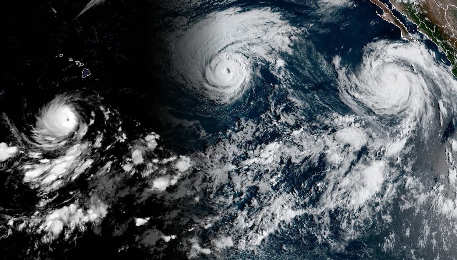
Three hurricanes—Karina, Lowell, and Marie—are currently active in the Pacific Ocean, a surge in activity that climate scientists attribute to an exceptionally strong El Niño event. Hurricane Lowell, which reached Category 5 strength before weakening to Category 3, is moving west and is expected to track near Oahu and Kauai this weekend. Meanwhile, Karina is weakening east of Hawaii, and Marie is strengthening off the coast of Mexico’s Baja California Peninsula.
This elevated storm activity aligns with forecasts from the National Oceanic and Atmospheric Administration, which suggests a 69% chance that this El Niño will become the strongest on record. Experts explain that warmer-than-average sea surface temperatures in the Pacific act as fuel for tropical cyclones, allowing them to intensify. This phenomenon is further compounded by a prolonged marine heat wave that has affected approximately 94% of the Pacific since January.
While the Pacific experiences this flurry of activity, the Atlantic basin remains relatively quiet, a pattern consistent with El Niño conditions that inhibit Atlantic storm formation. United Nations Secretary-General António Guterres warned that the planet is entering uncharted territory as extreme weather risks rise. He emphasized the urgent need for global climate action to protect populations from the intensifying impacts of these warming ocean waters.